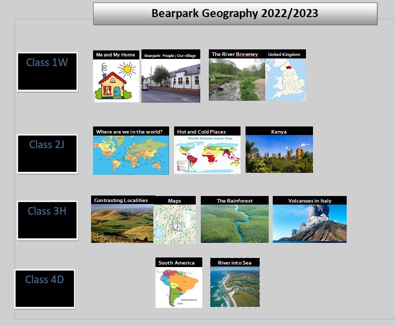
We want the children of Bearpark Primary School to know where they live and see the world beyond Bearpark School.
We do this by offering a range of opportunities including accessing outdoor learning and geographical enquiry. We want children to have a purposeful skills to use in their life and to prepare them for Geography at Secondary Education.
The Curriculum has been sequenced to enable children to build on what they know and prior learning of their immediate geography to their global geography.
Progression in Fieldwork 2023 to 2025
Fieldwork at Bearpark Primary School 2023 to 2025
Long Term Plan
Bearpark Primary Geography 2023 to 2025

At Bearpark Primary, we teach Geography progressively, focussing on the key skills; working geographically covering map and fieldwork skills, and key knowledge.
We teach the children about the importance of our locality, starting in our village and then looking beyond in our county, country, continent and the whole world.
- Geography MTP Progression – Year 1
- Geography MTP Progression – Year 2
- Geography MTP Progression – Year 3
- Geography MTP Progression – Year 4
- Geography MTP Progression – Year 5 and 6
Geography in Early Years
[Slideshow "geography" not found]
Geographical Vocabulary
| Reception | ||
| street | left | teacher |
| house | right | caretaker |
| bungalow | forwards | Head Teacher |
| school | backwards | cleaner |
| church | above | Police Officer |
| zebra crossing | under | doctor |
| traffic lights | tunnel | dentist |
| bridge | roundabout | map |
| Year 1 | ||
| near | transport | wind |
| far | lorry | snow |
| left | bus | rain |
| right | car | hail |
| building | summer | fog |
| plan | winter | wet |
| globe | autumn | dry |
| journey | spring | hot |
| travel | seasons | cold |
| long | short | wide |
| bungalow | junction | narrow |
| town | village | farm |
| Year 2 | ||
| England | location | Dublin |
| Scotland | route | Equator |
| Northern Ireland | aerial view | North Pole |
| Eire | landscape | South Pole |
| Wales | environment | Irish Sea |
| North | London | North Sea |
| South | Edinburgh | English Channel |
| east | Cardiff | local |
| west | Belfast | distant |
| semi-detached | terraced | address |
| larger | smaller | behind |
| city | desert | ocean |
| beach | cliff | coast |
| forest | hill | mountain |
| sea | river | valley |
| soil | vegetation | seasonal |
| port | harbour | factory |
| Year 3 | ||
| settlement | valley | mountain |
| community | vegetation | weathering |
| landscape | soil | erosion [within weathering] |
| relief map | peat | port |
| political map | loam | harbour |
| cliff | clay | factory |
| ocean | lake | office |
| fieldwork | transport [carry] | industry |
| sketch | diagram | compass |
| North East | South East | North West |
| South West | weather | climate zone |
| polar | equator | tropical |
| longitude | latitude | environment |
| Year 4 | ||
| greenhouse | valley | warm |
| polytunnel | contour | humid |
| intensive farming | height | coastal |
| arable farming | hydroponics | evaporation |
| market gardening | allotment | precipitation |
| mixed farming | distribution | condensation |
| organic farming | import | hemisphere |
| distance | export | productivity |
| scale | native/ indigenous | natural resources |
| grid reference | sustainable | man-made materials |
| satellite | weathering/erosion | hemisphere |
| settlement patterns | natural disaster | tropical |
| inland | ox-bow lake | polar |
| urban/ rural | spring [water] | trade |
Year 5
| climate/ weather | flood plain | deposition |
| climate zones | meander | transportation |
| tributary | surface | confluence |
| vegetation belts | sea level | mouth |
| river | grid reference | source |
| delta | terrain | products |
| ox-bow lake | features | industrial |
| grid reference | contour lines | continent |
| landscape | natural | sub-continent |
| water cycle | population | development |
| arid | precipitation | irrigation |
| evaporation | condensation | ground water |
| settlement | industry | tourist |
| excursion | scale [maps] | contours |
| Year 6 | ||
| migrate | naturalised | Arctic |
| disperse | indigenous | Antarctic |
| sustainability | immigrant | renewable |
| natural disaster | survey | population |
| natural resources | questionnaire | biomes |
| canopy [trees] | latitude | vegetation belts |
| Ordnance Survey | longitude | climate zones |
| distance | Greenwich/Prime Meridian | conservation |
| scale | Time zone | pollution |
| grid reference | Northern hemisphere | export |
| symbols | Southern hemisphere | import |
| urban | Tropic of Capricorn | tropical |
| rural | Tropic of Cancer | equatorial |
| land use | Equator | subterranean |
| congestion | latitude | location |
| pollution | longitude | minutes[location] |
| tectonic plates | deforestation | magma |


